Data●●Solid

AusOverwatch – Real-time geospatial intelligence for Australia
Beautiful Australia-specific data aggregation, but Google Maps already shows most layers.
Eye CandyNiche Gem
kangablue
203mo ago
Polished geospatial dashboard, but FlightRadar24, Windy, and USGS already do each layer better.
Data visualization enthusiasts, travelers, weather/space hobbyists
FlightRadar24 · Windy.com · USGS Earthquake Hazards
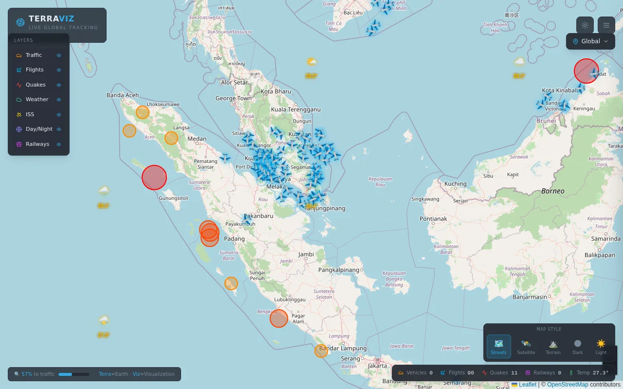
Data sources: OpenSky (flights), USGS (earthquakes), Open-Meteo (weather), Open Notify (ISS), Overpass/OSM (roads and railways). Vehicle movement is simulated client-side using interpolation along OSM way geometries.
Each layer fetches independently with its own error handling so one API being down never breaks the rest. Map state persists to localStorage and first-time visitors get geolocated via ip-api.com.
Stack: Vite, React, Leaflet, Tailwind CSS.
Would appreciate feedback or suggestions for more data sources to add.
Beautiful Australia-specific data aggregation, but Google Maps already shows most layers.
Google Maps 3D flight sim, but it's a thin interactive wrapper without depth or persistence.
10K flights in 3.5MB WASM bundle is impressive constraint engineering for browser rendering.
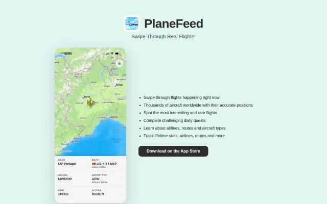
TikTok-style swipe for flights is fun but FlightRadar24 already shows this data.
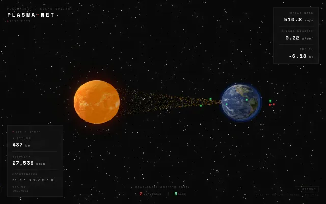
Live solar wind visualization layered over ISS tracking—neat combo nobody asked for.
Yet another 'own a piece of X' scheme with no technical differentiation.