Data●●●Banger
I mapped what's within walking distance for European cities using OSM
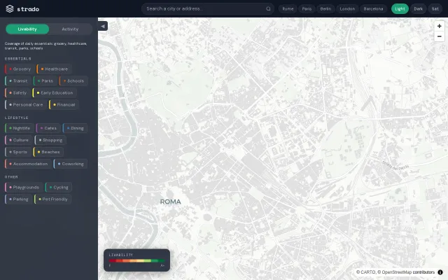
Hex-grid walkability scores beat Walk Score's coarse neighborhood averages.
Rabbit HoleBig Brain
strado
221mo ago
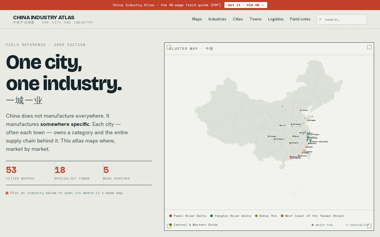
One city, one industry: maps China's manufacturing specialization by location.
Supply chain professionals, researchers, journalists, manufacturers sourcing from China
Hex-grid walkability scores beat Walk Score's coarse neighborhood averages.
2D embedding visualization makes browsing 5000 YC companies genuinely explorable.
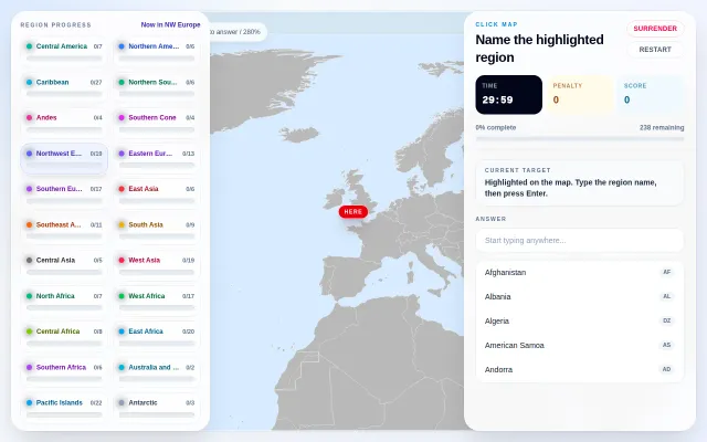
Fun geography drill, but Seterra and Worldle already dominate this space.
Pretty map of where builders hang out, but unclear retention or differentiation.
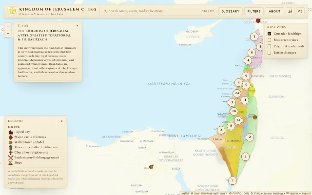
Hand-curated atlas mapping 170 Crusader sites onto modern geography with surviving remains.
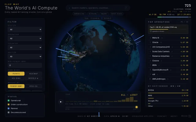
Stunning 3D globe tracking 725 AI clusters and 80M H100 equivalents globally.