Gaming●Mid
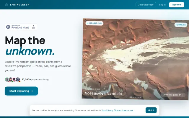
EarthGuessr – Guess locations from satellite imagery
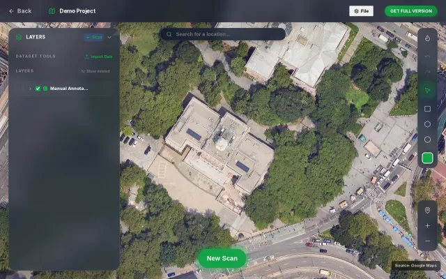
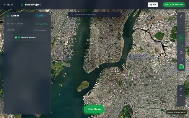
GeoGuessr clone with satellite imagery—10k players but no real differentiation.
Crowd PleaserCozy
fredrikmoger
3010d ago

Real satellite thermal detections at military sites beat generic news feeds for truth.
People living in the Baltics, OSINT enthusiasts, journalists
ACLED · Crisis24 · FlightRadar24
Especially when living in Baltics it's basically 24/7 fearmongering here from anywhere, either it's constant russian disinfo targeted campaigns via their chains of locals or social media campaings or some bloggers chasing hype on clickbait posts, so it was driving me mad, and it is distracting and annoying when someone from your closest ones got hooked on one of these posts and I was wasting time to explain why it was a bs.
So I took my slopmachine and some manually tweaking here and there and made this dashboard. Main metric is basically a daily 0-100 threat score, which are just weighted sums and thresholds - no ML yet.
GeoGuessr clone with satellite imagery—10k players but no real differentiation.
Real SDR satellite station with AI transcription, packet decoding, and weather image recovery.
VLM-based satellite detection sounds good until you remember YOLO and specialized models handle occlusion better.
Skip the dashboard: security breach alerts in two sentences sent directly to Slack.
Tile-based VLM inference with coordinate projection, but dense objects still need YOLO.
One-line monitoring for agents; drift + security scanning matter for production, but early MVP.