Data●●Solid
Live Sun and Moon Dashboard with NASA Footage
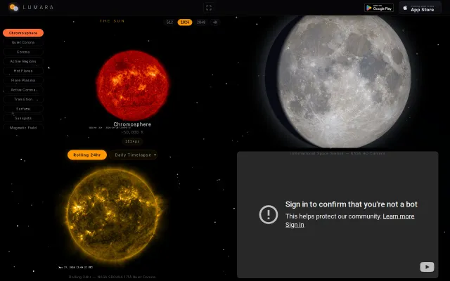
Real-time NASA solar feeds paired with offline moon phase math is a killer combo.
Eye CandyNiche Gem
beeswaxpat
224692mo ago
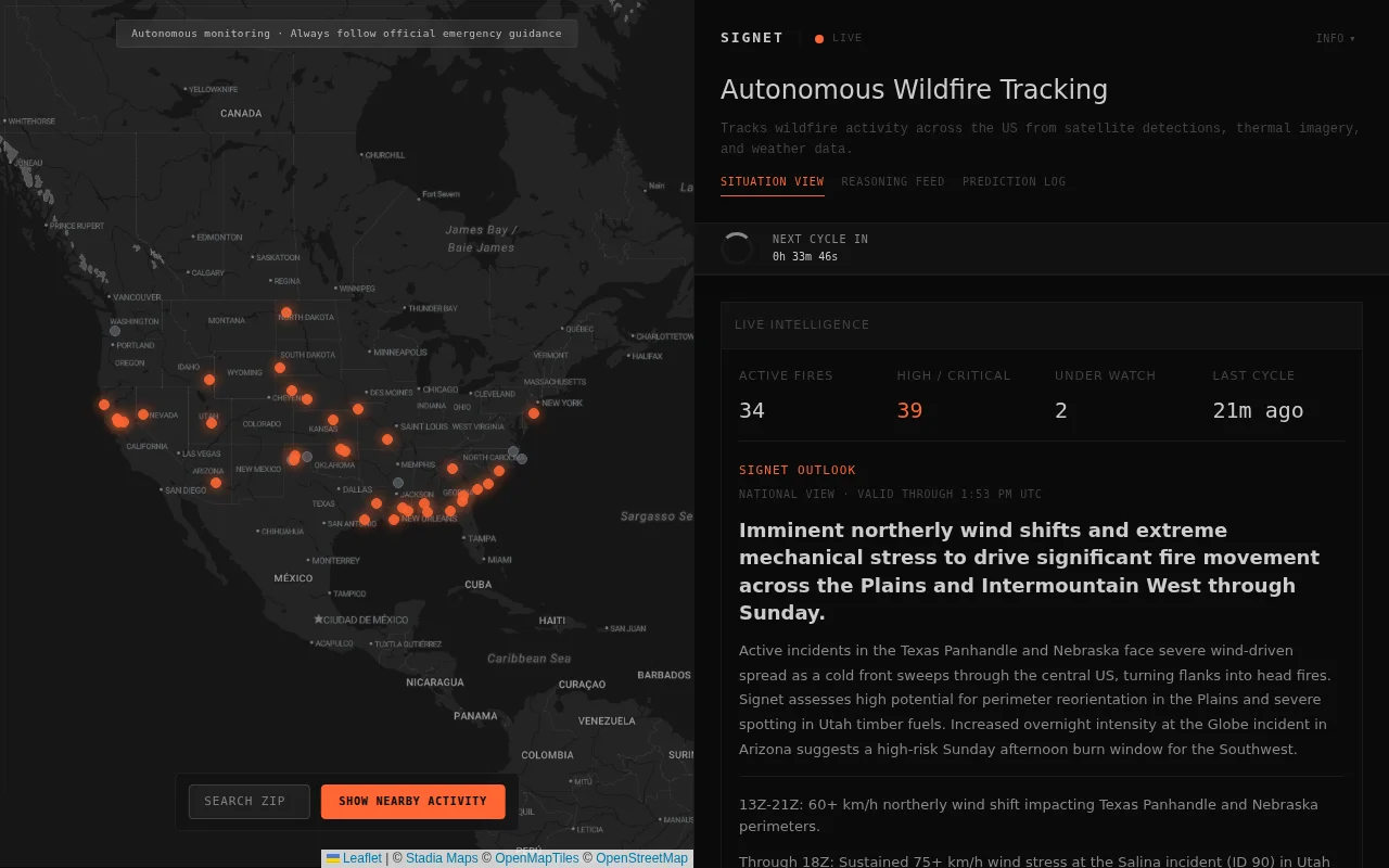
AI orchestrates 23 tools across weather, terrain, and imagery where deterministic rules break down.
Emergency responders, researchers, fire management professionals
FIRMS · Global Fire Watch · Windy.com
All the data already exists: NASA FIRMS thermal detections, GOES-19 imagery, NWS forecasts, LANDFIRE fuel models, USGS elevation, Census population data, OpenStreetMap. The problem is it arrives from different sources on different cadences in different formats.
Most of the system is deterministic plumbing - ingestion, spatial indexing, deduplication. I use Gemini to orchestrate 23 tools across weather, terrain, imagery, and incident tracking for the part where clean rules break down: deciding which weak detections are worth investigating, what context to pull next, and how to synthesize noisy evidence into a structured assessment.
It also records time-bounded predictions and scores them against later data, so the system is making falsifiable claims instead of narrating after the fact. The current prediction metrics are visible on the site even though the sample is still small.
It's already opening incidents from raw satellite detections and matching some to official NIFC reporting. But false positives, detection latency, and incident matching can still be rough.
I'd especially welcome criticism on: where should this be more deterministic instead of LLM-driven? And is this kind of autonomous monitoring actually useful, or just noisier than doing it by hand?
Real-time NASA solar feeds paired with offline moon phase math is a killer combo.
Seven-model consensus with fractional Kelly sizing beats the standard LLM-only trading bot.
LLM-powered incident grouping with MCP server when Datadog and Honeycomb already dominate.
Another satellite tracker when Celestrak and existing tools already cover this.
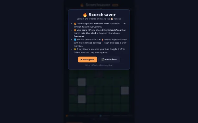
Wind-shift mechanics force dynamic backfire strategies unlike static fire-blocking puzzles.
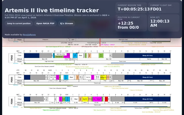
Clean timeline visualization for a mission that doesn't launch until 2026.