Other●Mid

I built Istanbul live transit map
Live Istanbul transit map is useful locally but lacks novel tech or broader appeal.
CozySolve My Problem
berkaycubuk
1122mo ago
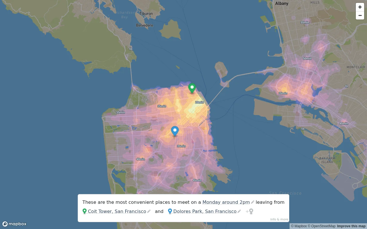
Transit-weighted heatmaps beat Google Maps for planning real-world meetups.
Urban planners, remote teams, anyone coordinating meetups
Google Maps · Citymapper · Transit
I built a map that generates a heatmap of the most convenient meeting spots between several people, based on public transit travel times.
Move the markers anywhere in the map; all cities with sufficient transit data are supported!
Live Istanbul transit map is useful locally but lacks novel tech or broader appeal.
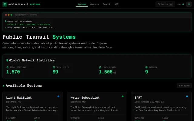
Terminal aesthetic can't hide only nine transit systems in a worldwide database.
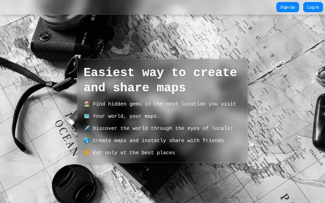
Google Maps is clunky, but this landing page offers zero proof of a better map engine.
In-browser RAPTOR routing with zero backend beats TravelTime API for Swiss transit.
Claude Code joining your Zoom call and coding live while you talk is genuinely wild.
AI wrapper for meeting triage when Calendly and CRM tools already handle this.