Social●●Solid
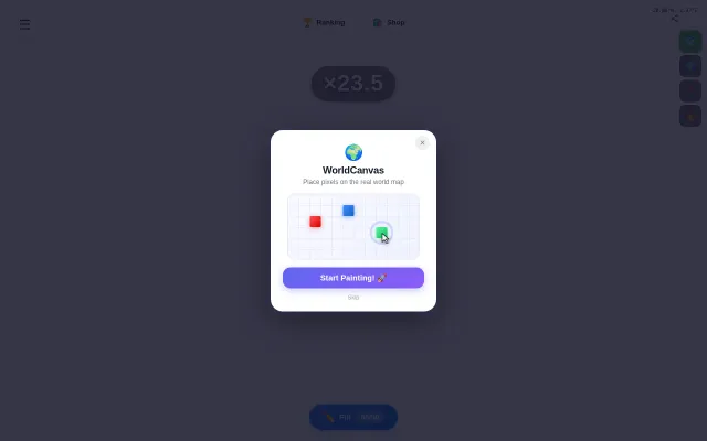
WorldCanvas – R/place, but with a real world map as the canvas
r/place on actual map coordinates with WebGL zoom—clever technical execution, limited staying power.
Crowd PleaserEye Candy
recuerdame
313mo ago
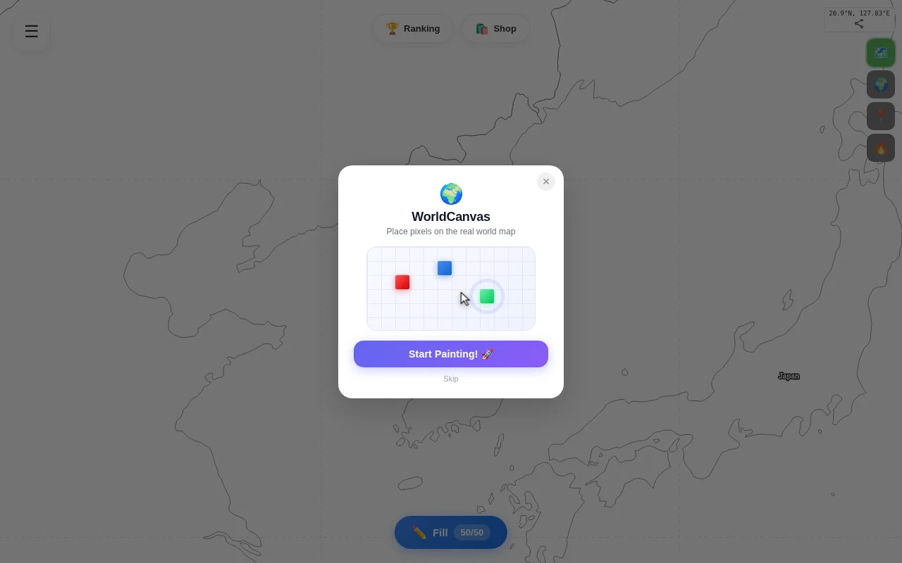
2.6-trillion-pixel r/place on a real map with mipmap rendering—genuinely clever technical solution.
Pixel art enthusiasts, collaborative art communities, geospatial explorers
r/place · Collaborative Canvas (Discord Bots)
What I tried and what worked:
- Canvas2D → WebGL: At wide zoom, Canvas2D couldn't keep up redrawing millions of pixels. Switched to a WebGL renderer with mipmap-style tile pyramids – pre-rendered lower-res textures for each zoom level, only loading full-res tiles when you're close enough.
- Viewport-scoped SSE: Instead of broadcasting all pixel updates to every client, the server only streams changes within your current viewport bounds. Cuts bandwidth by ~95% for a sparse map.
- Mercator pixel mapping: Each pixel maps to a real geographic coordinate. The tricky part was making pixel density feel uniform despite Mercator distortion at high latitudes.
- Seeded pixel art: Pre-placed recognizable characters in major cities so new users see something interesting immediately instead of a blank map.
Stack: Node.js, WebGL, SSE, S3 tile storage, Lambda for tile generation.
Free to use, no account required to browse. Still early – would love feedback on the rendering approach.
r/place on actual map coordinates with WebGL zoom—clever technical execution, limited staying power.
Spatial git diff viewer that beats scrolling through 20 separate file tabs.
WebGL 2 instanced rendering optimization of a known tool, not a novel approach.
ASCII cartography with live aircraft data is fun, but ultimately a novelty like terminal Google Maps.
MapLibre spec layer with DuckDB widgets, but Mapbox GL JS + alternatives already solve this.
Inverse material rendering in browser that's faster than m-xr's marso and academic papers.